Travel 2020-2021
Software Science Project
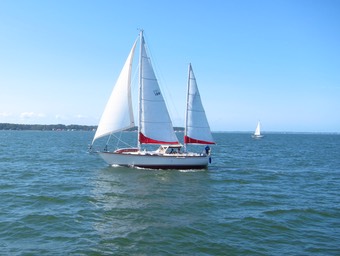
Sailboat mysteries are bad. Knowing how everything works is sort of the point. And knowing how everything works may also be life-or-death.
The electronics on Red Ranger can be split into two groups:
- Portable. This includes phones, iPad, computers, watches. A hand-held VHF radio.
- Fixed. This includes the two chart plotters, the instrument repeaters, the AIS transponder, the two VHF base stations, the entertainment system.
The two lists are (intentionally) short. It’s essential to be sure of each item, and where it is. The classic “I think there’s one in the forward hanging locker. Or. Maybe I gave it away to someone” isn’t really a good policy.
The Commodore is pretty sure we should be able to list all the things we own. Off the top of our heads. In an emergency. This is either a consequence of minimalism or one of the reasons we've adopted a minimalist life-style.
There are two other ways to partition the electronics.
- Updatable Software. The phones, iPad, computers, watches. The nav station Zeus2 chart plotter. The instruments, for the most part, all have updates available. This is a worrisome thing.
- Firmware only. The Standard Horizon chart plotter, all three VHF radios, the entertainment system. This is a “yay”. Turn them on and they work.
There’s some overlap between items in the Portable and Updatable categories. That means a few hours of WiFi and many of our things are all patched and ready for use.
The lack of overlap is notable. The Zeus2 chart plotter and the instruments need an update, but we’re not dragging Red Ranger into the marina lounge for some quality WiFi.
Shout-out to Herrington Harbour North for having fabulous WiFi on the docks. Shout-out to B&G for making it possible to connect to WiFi and download patches and updates.
At this point, we’re several updates behind. Each time I turn on the nav system, there’s this kind of thing.
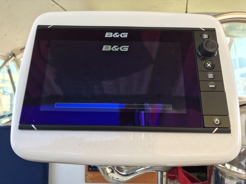
We’ll be applying as many updates as we can through WiFi. It’s easy and nearly painless. (Not completely painless. Each reboot involves silencing a warning that we’re moving too slowly. It’s the “adrift” alarm, and I think I need to disable it.)
We have at least one known problem. And one mystery.
The Zeus2 can’t update the Simrad AP44 Autopilot Control; it needs its software on a USB drive. (Formatted FAT32, which can be challenging enough.)
There’s a list of updates on the chart plotter that can’t be applied. I’m not sure precisely what this means. A mystery is a potentially bad situation arising at sea. I’d like to have no mysteries.
This coming weekend, I’m going to make a careful list of what needs to be updated and how the updates are performed. I have a theory that I need to download the files and put them into a MicroSD card that the Zeus2 can read and propagate. I’m not sure how this is going to work, so stay tuned.
I’ve also got to update the charts. For the US, this is a download from NOAA’s Office of Coast Survey. Outside the US (i.e., the Bahamas) I need to buy charts.
The sidebar task is to actually write down the steps required for software and chart updates. The software update *should* be as accessible as bending on the stays’l with a halyard and two sheets. Emphasis on should. There should be no science project software or mysteries on a boat.

Red Ranger Prep — High Heat Index
She’s been on the hard for about a year.
We had emptied every battery container (except one.) We had opened every locker and drawer.
We’d even disconnected the vent fan for the Air Head composting toilet. The only thing left on was the bilge pump. On the hard, she takes on water through an obscure path, and a pump has to be left running.
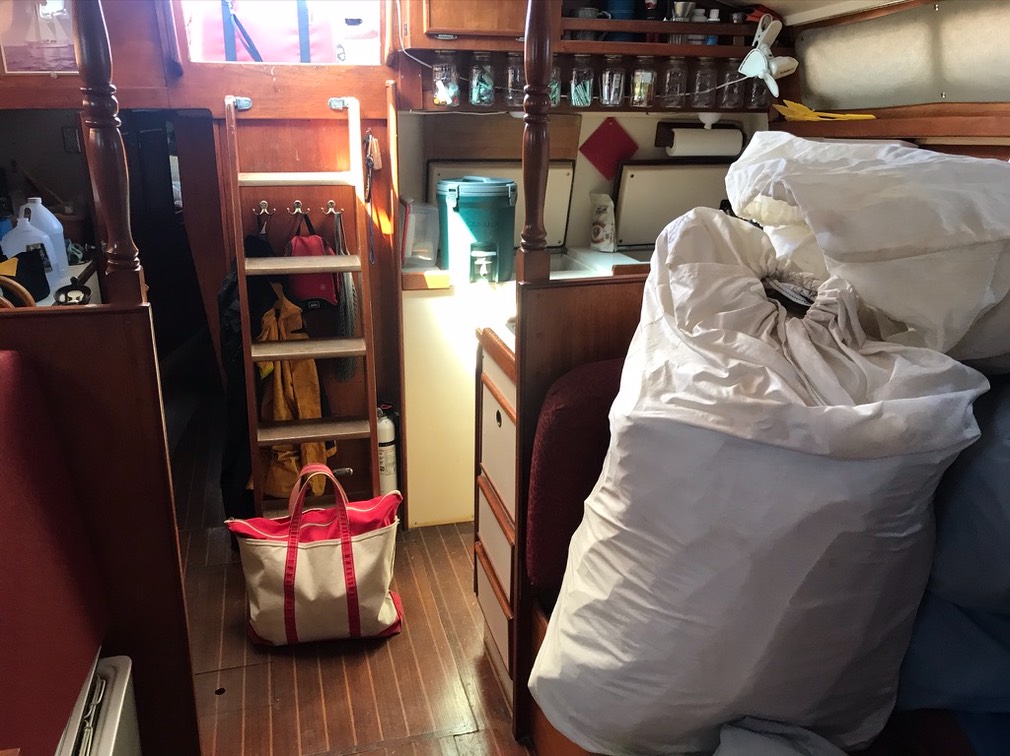
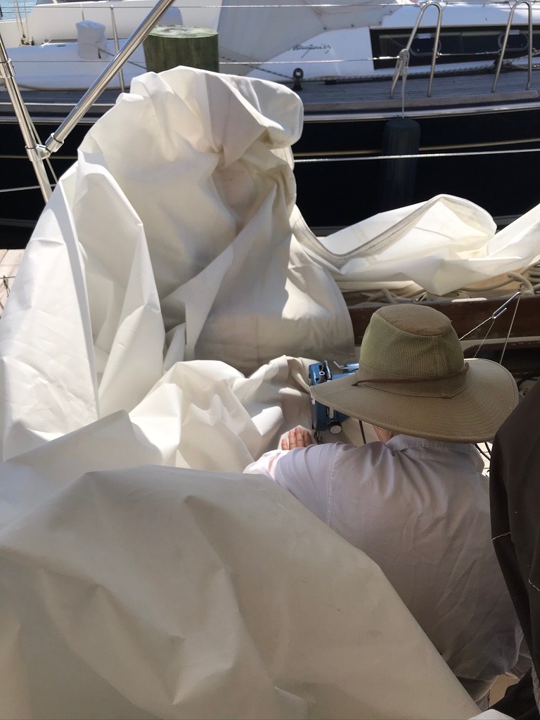
This was my “we’re back home” picture. Sailbags and our canvas tote bag.
There’s a lot to do. But. The Chesapeake was unforgivingly hot. A year in Nevada taught us that 40°C (104°F) is manageable. If there’s no humidity. And you’re not doing anything.
35°C (95°F) with a relative humidity over 50% is about the same as 40°C in the desert. The Heat Index suggests we take it easy.
As soon as we start working, we enter the realm of projectile sweat.
We're dripping everywhere. On everything.
We have to drink more-or-less constantly. And the water tanks haven’t been cleaned. So we’re bringing dock water into Red Ranger in buckets.
Jobs are broken into pieces where you can sit down in the shade and sweat for a while.
- Move the sail to the cockpit. Rest.
- Move the sail to the mast. Sweat Break.
- Bend on the sail to the extent possible. Water Break.
- Furl or flake and maybe think about the cover.
Four sails. Two weekends of two days each. That’s a day for each sail.
One was particularly difficult, though.
The yankee required restitching the sacrificial panel. Most of the panel is still in good shape. The threads had started to fail. So we staged all 49’ or so feet of yankee in the cockpit and forced it through the SailRite machine.
Three times.
Once for each line of stitching on the sacrificial panel.
Then we took a long break.
Then be followed the four-step procedure for getting it onto the forestay. Which involved long breaks after each step.
We think next weekend may be down to 30°C. We might be able to start washing the interior. Maybe change the oil. Maybe add another USB charging port (we have four pairs, but, you know, everyone has a watch and a phone, and if we have guests we could need as many as six pairs.)
Stay tuned.

D+5 — London, OH, to McLean, VA
We’re not “home” yet. We still have to move in.
But we’re in the neighborhood. And tomorrow we’ll finish this.
The south-eastern corner of Ohio, a tiny sliver of West Virginia, southern Pennsylvania, and Maryland provided some scenery.
Much of today was a winding, hilly road.
The bonus?
Traffic.
As you descend toward the Dumbest Interstate Design Decision Ever — the I-70 clusterf**k known as Breezewood — the traffic picks up while the road gains turns and twists. Check the date; we’re doing this on the Sunday after a long 4th of July weekend. So. The traffic was predictable.
The Breezewood Interchange drops you off I-70 Pennsylvania Turnpike toll road onto US-30. You have traffic lights and what-not. The world’s biggest truck-stop. And then back onto I-70 freeway. Some claim an obscure law made this somehow necessary, but that’s only half the story. The law was an excuse to do the wrong thing while claiming a budget win. See https://www.outsidethebeltway.com/everybody-hates-breezewood-pennsylvania/ for some details.
Tomorrow at 08:00 we can start moving in to our apartment. Once the truck is empty, the trip will be complete.

D+4 — St. Louis, MO, to London, OH
This has greenery and a few valleys. But. Missouri, Indiana, and western Ohio are all respectably flat and very similar-looking.
Today was a short-ish day of driving, but we crossed a lot of state boundaries in one day. We’re getting set up for the final day, which includes Ohio, West Virginia, Pennsylvania, Maryland, and Virginia. Busy day.

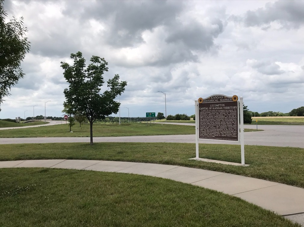
D+3 — Salina, KS, to St. Louis, MO
It was hard to take a picture that feels like it captures eastern Kansas and western Missouri. It’s not the epic flat of central and western Kansas. It looks a lot like much of the east. Trees. Fields.
Historic Markers. (This is outside Lawrence, KS.)
Maybe tomorrow we’ll pass something that says “Missouri” to us.
I was confused crossing the Missouri river twice. We crossed it once in Kansas City and again here at “airport/riverport” just west of St. Louis, proper. Tomorrow, though, we cross the Mississippi and leave the west behind.
This river port area is a suburban office building campus. It’s not scenic, and it’s good we brought left-overs with us from Salina. This is one of those weirdly isolated places — we’re surrounded by cities, but there’s no neighborhood right here. The closest sign of civilization is other hotels, a gas station, and a fast-food joint.
This is COVID-19. Many things are closed or have reduced hours. These acres and acres of office buildings have empty parking lots.
But even if people were using the office buildings, there’s nothing here but parking and a gas station.
Next time, we need to find a less isolated-feeling place to stay.

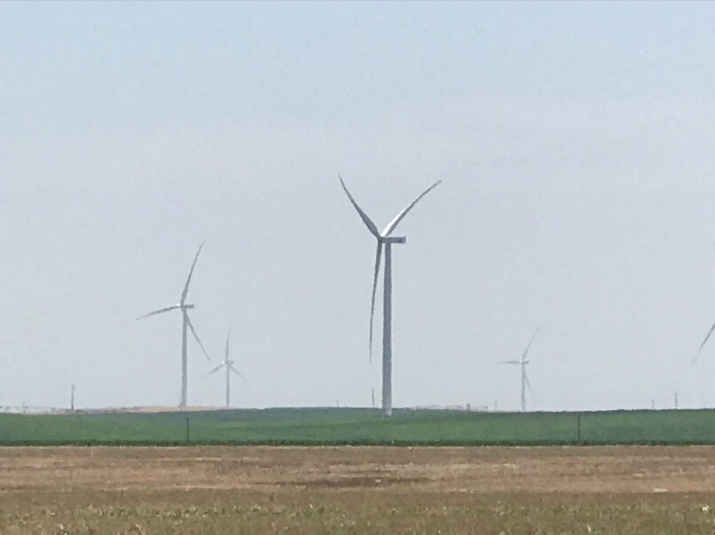
D+2 — Golden, CO, to Salina, KS
Eastern Colorado and western Kansas are a lot of emptiness.
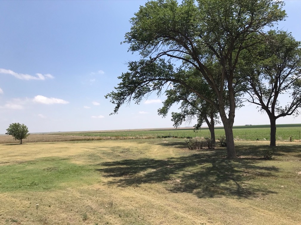
There’s agriculture. And a little oil production.
There’s a ton of wind. We had to take pictures of it.
It took some searching to find Martinelli’s in Salina. Wow. It was fabulous. It was huge. We split it, and had half on Thursday. We packed fresh ice in the cooler and had the other half on Friday in St. Louis, MO.
The best part was the scenic, downtown Salina. Other than the grain silos, they have a very, very cute downtown.

D+1 — Cedar City, UT, to Golden, CO
This was a long day. Upon review, it’s better to stop in Grand Junction and maybe do a little hiking there.
Here’s the view from I70 in northern Utah.

From there, it transitions to forested mountains. I70 winds through canyons in western slope.
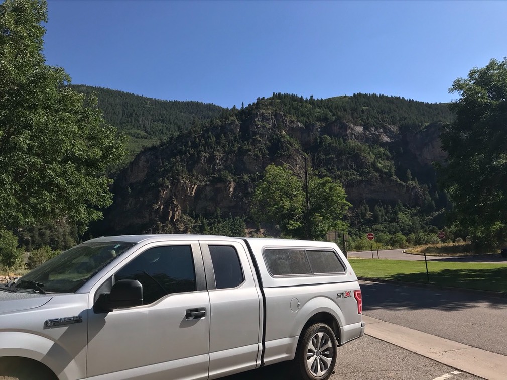
Then you’re into the high peaks. Famous ski resorts and towering mountains. The long downhill to Golden is at the end of a very long day.
A place called The Tequileño had some enchiladas that were quite nice.

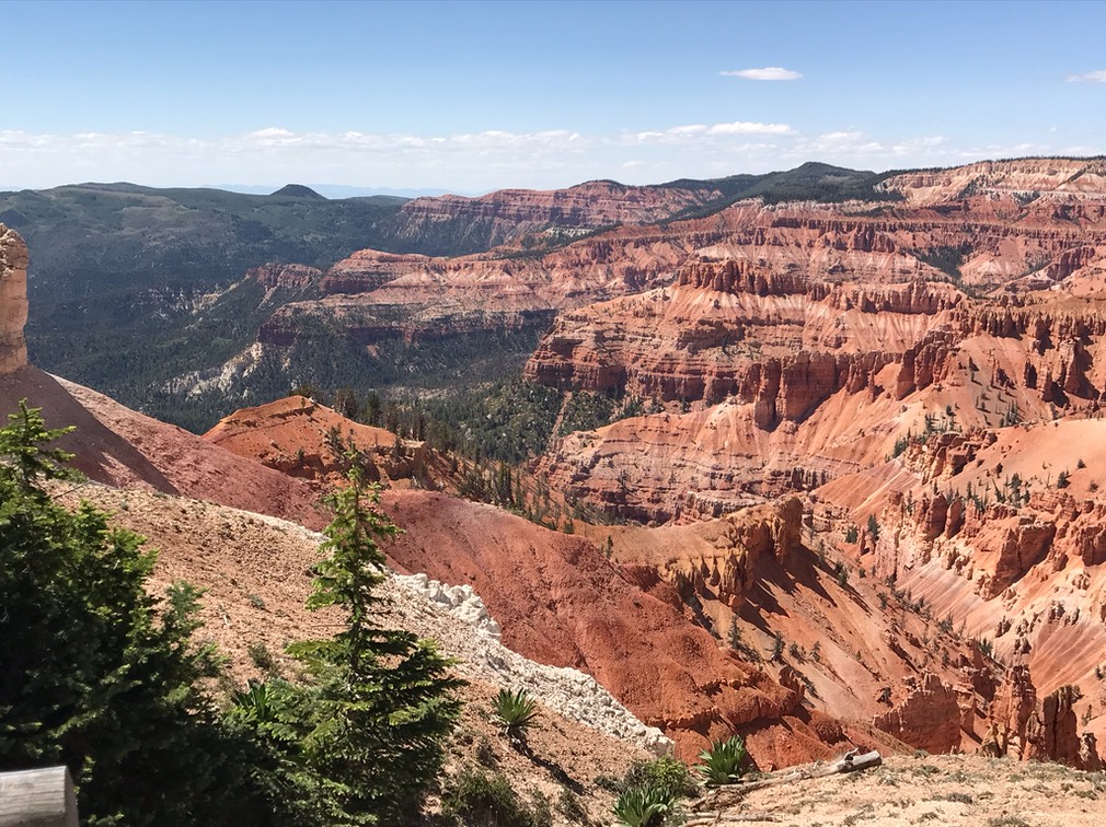
D-day — Las Vegas to Cedar City, UT
We kept the first day short. We also failed to realize where the border with Mountain time is.
The objective was is a short jaunt up I15 with time left for a hike in the Cedar Breaks National Monument. The time-zone change meant we had an hour less than we’d originally thought.
The good news?
Hiking at 10,000′ requires patience. You can’t walk far or fast. The timezone shift was a good thing.
Takeout from the Lighthouse Seafood was amazing. The dinners were huge, and we should have split one instead of ordering two. But it was soooo good we stuffed ourselves.
