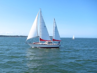
Travel 2017-2018
A Million Things to Do
She’s a boat — there are always things to do. We have enumerated the jobs using Trello. There are 51 things on the backlog. Okay. It’s not a million. Some are really complex. Others are a trip to Home Depot to find the right gasket for the faucets.
Instead of work, we practiced our boat handling skills. Which is code for “took a trip.” Specifically, we went up to West River Sail Club to eat crabs and visit with the folks there. And dodged weather.
There will be other weekends to tackle the jobs.
Winds were light when we started. When. We. Started.
Below 4 kn, we don’t really move. But a 5 kn breeze will push us along, slowly. It’s a 16 nm trip. Anything better than 3 kn and we’ll get there in time to eat crabs.

Here’s the autopilot display when sailing. The “W” means we’re sailing by the wind. The 109 is the current angle to the wind. the 106 is the desired angle.
Yes. The display says “Simrad”. The B&G unit that performs essentially the same function didn’t look right. (The existing holes were evenly spaced. The narrower-than-everything-else B&G Autopilot control didn’t look right.)
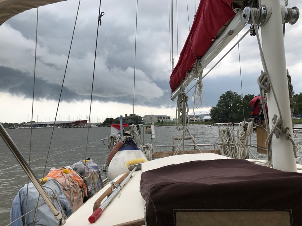
It’s summer on the Chesapeake. The clouds were big and getting bigger.
Then. The dreaded VHF WX alert. Severe thunderstorms in central Maryland, headed east at 40 miles per hour. Gusts to 60. Seek shelter.
It’s central Maryland. Storms tend to drift northeast. Why worry?
On the other hand. We’ve been through this on the Bay. And it’s not a lot of fun. We got hit at the mouth of the Patuxent River by one of these “seek shelter immediately, small-craft advisory, you’re all going to die” storms. Red Ranger can handle it.
We got hit by a waterspout in the Neuse River. It was an amazing amount of wind and rain. It was not anything we care to repeat.
Mr. Lehman to the rescue. We brought in the sails, aimed the new B&G chart plotter to West River Green “1” (38° 51.84′N, 076°27′W.) After that, it’s a little hand-steering for about five more miles to the WRSC. And a chain of WX alerts on the VHF radio. Different locations. But the same devastating wind and rain.
Then the alerts to mariners started. Because CA suggested we get under cover when the first alert come over the radio, we were only 3 miles from the WRSC when the marine alerts started.
We had about a half-hour to go. And the clouds were low, dark, and getting darker.
We passed boats heading out into the bay. Did they not have radios? Were they not looking at the clouds?
Skill #1 — Watching the Weather. We read the forecast for late afternoon thundershowers. This wasn’t a surprise.
And more important than that.
Skill #0 — Cooperative Decision-Making. By which I mean, when someone says we’re seeking shelter, we went in.
We picked up the mooring ball on the first try. We got to be pretty good at it when we lived in Coconut Grove in the Dinner Key mooring field. We missed the ball a few times. Once we lost two boat hooks trying to get the ball when it was breezy.
It’s essential to approach the ball to windward. That sometimes means threading a path through the mooring field. For WRSC, there are only five balls and no one was using them. So the only tricky part is aligning with the wind. The B&G computer calculates the true wind by factoring boat speed and current into he apparent wind, making it easier to judge the approach in general.
From the helm, I can’t see the ball below the bowsprit. But, I can see Queequeg on the bow with the harpoon. She points the boathook at the ball, and I steer to keep it to starboard. When the hook goes down: hard reverse to stop at the ball. Then run forward to help. The boat’s massive. The balls often have a heavy pile of chain on them.
Skill #2 — Steering.
Skill #3 — Mooring. Which has a long list of skills that coalesce around securing the boat.
Since we don’t have a good sail cover for the main, I tied it to the boom. This is one of those sailorly things. As with securing the boat to a mooring, all of the sails need to be secure. We tighten the furling drums on the headsails. Tie down the main and zip the cover on the mizzen.
We can see the tent were the crabs are cooking. We can see people. And the wind is starting to pick up. As we’re standing on the foredeck, getting ready to launch Scout (the dinghy,) the wind starts to shift.
That’s enough of that. Tie Scout back down, grab everything loose and throw it into the cockpit.
Here’s the strip-chart recorder.
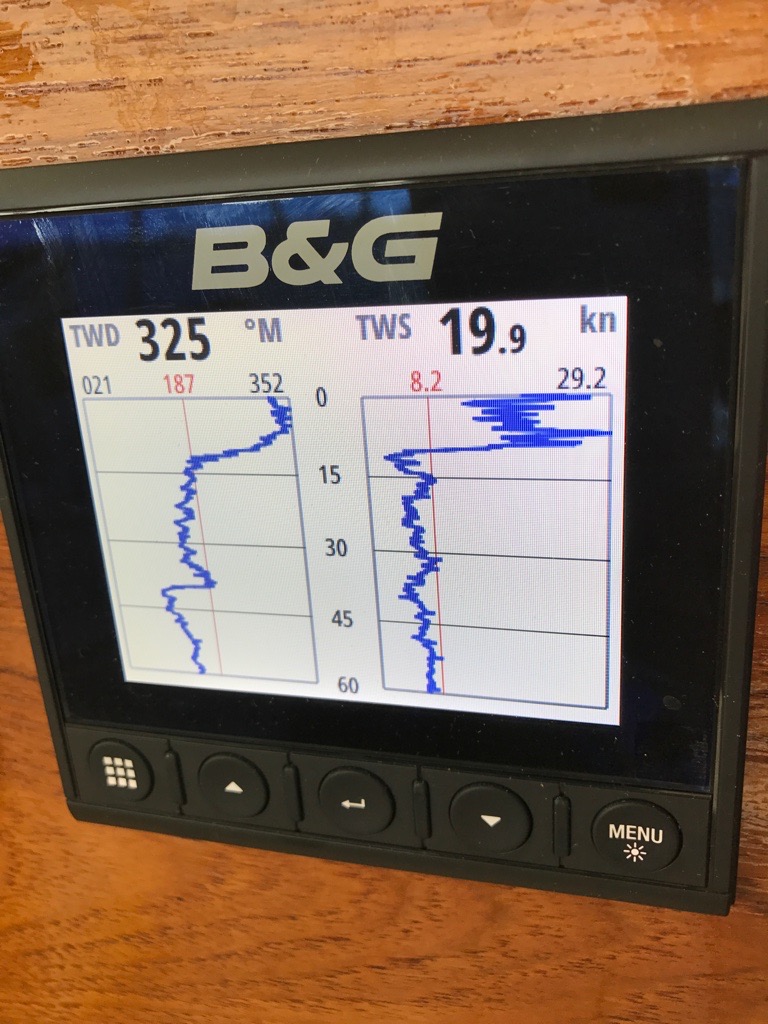
Up until about 10 minutes before I took the picture, we had wind below 8 kn, from about 180°. Then the wind switch to about 350° and jumped to a peak of almost 30 kn.
The 30 kn gust, BTW, almost knocked me down. I was scrambling across the foredeck. Pow!
Skill #4 — One hand for yourself, one hand for the boat.
Skill #5 — Patience.
The blow lasted less than 30 minutes. The wind stayed about 350°, but dropped to a sensible speed. We deployed Scout, dinghied in, ate crab, drank beer, schmoozed with sailors, helped clean up, and went back to Red Ranger. Great sail. Great party.
The next morning was a glorious, calm, quiet creek. Coffee. Oatmeal.
We took on 60 gallons of fuel, and worked our way back to Deale. The storm pattern was the same as Saturday. We pottered around in the light air. Then we started the engine and powered into Herring Bay watching the clouds build. We got into the slip without breaking anything. Tied up the sails, and hunkered down in the cockpit just as the first guts of the thunderstorm hit.
By 16:00 the skies and cleared, and we could pat ourselves on the back for escaping two nasty squalls in two days and eat plenty of crab at the Sail Club.

Sea Trials — Did Everything Work?
The bottom line on boat maintenance is the sea trial. It may look like things are working when you’re in the slip. Getting out into the open water is where — metaphors fail me. The rubber doesn’t hit the road. There’s no pudding to be proven.
There were several momentous things this weekend. I’ll enumerate them. There were two collisions, but so many things were perfect, that it’s a joy to review the good parts.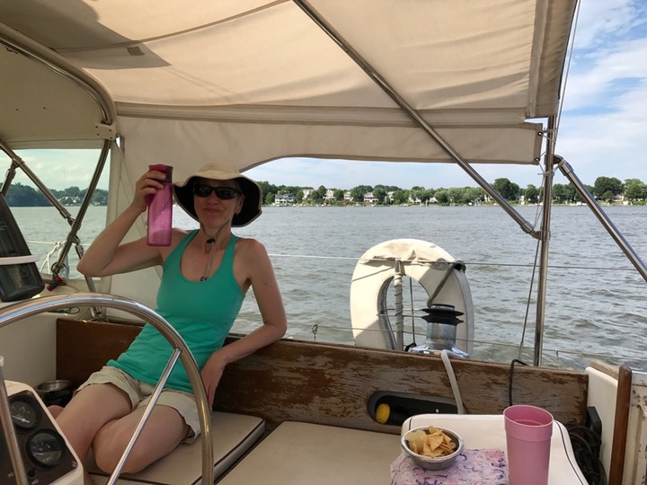
What’s at stake here?
First — a metric ton of new electronics. The electronics don’t way a ton. The containers of money weighed a ton. A metaphorical ton. ("a ton of dollar bills would be worth $908,000”) We spent a lot. Think of a small car.
It’s all new. The masthead wind instrument. Water speed. Depth. Temperature. GPS. A computer to integrate them. Remote displays to emphasize key data elements. A navigation computer to control the hydraulics. A class B AIS Transponder.
Saturday, we backed out of the slip. Momentous.
Let me emphasize the extreme difficulty we’ve had with this simple-sounding maneuver. The fairway between the slips is barely 60’ wide. The boat is 42’ plus a bowsprit. It’s a tight fit. And mistakes are easy to make.
Each attempt last year involved a fair amount of random jockeying around to get Red Ranger pointed in a useful direction. She doesn’t operate in a very controlled manner in reverse. Think of throwing you car in reverse and telling someone else where to turn the wheel to back up.
One (of many) crucial features of the new electronics was a “Rudder Position Indicator.” The technicians installed a sensor near the rudder to collect the data. Integrated it with the computers. And — hey! presto! — we can now tell where the rudder is.
10°-15° of rudder is what it takes to turn Red Ranger in reverse. More doesn’t make her turn faster: at some point the rudder is so far sideways that it simply stops the boat. I now know where 10°-15° of rudder is because I can see a display of the rudder’s position.
The weather couldn’t have been better. Saturday had about 15kt of wind from the NW. The course to the West River and the Rhode river is NE, so we could beat at a comfortable angle under main and yankee. Speeds were over 6 kt at times. For Red Ranger, the theoretical top speed is 8.2 kt. We have our doubts about ever seeing this under sail. Seeing 6 kt was a delight.
It got better.
We went up past the Thomas Point lighthouse. Too enthralled with the sailing to lift up a phone and take a picture.

(This picture is from 2011. It hasn’t changed much. Except this weekend the sun was out, there were boats everywhere.)
The sailing was comparable to the British Virgin Islands. Seriously. The steady wind from a consistent direction meant that we could tack into the West River.
I’ll repeat that because it’s momentous.
We Tacked Into The River.
Yes. We actually beat to weather. All the fancy electronics in the world don’t change the inherent shabby performance of a Whitby. As sail boats go, Red Ranger is appalling. As vacation homes go, however, she rocks.
For non-sailors, the problem is that racing sail boats can point no closer than about 45° toward the wind. Big cruising boats can point no closer than 55° or 60° to the wind. When you need to get to a place that’s more-or-less upwind of where you are now, you go 60° one way, tack, and go 60° the other way, zig-zagging your way toward your goal. The secant of 60° is 2.0 (What?) In Red Ranger, we sail twice as far to use zero fuel.
As we were sailing around, CA spotted a tug pushing a barge. The rules of the road give us some precedence, but it’s kind of rude to use that privilege when we’re just out playing the tug captain is working. As she’s discussing falling off the wind to go behind it...
The tug hailed us by name on the VHF radio.
That’s momentous. The tug captain asked for Red Ranger. On the radio.
How did that happen? AIS class B transceiver. The tug shows up as a triangle on our chart plotter. And we show up as a converging triangle on theirs. I grabbed the radio, answered the hail. Switched to channel 13 (the working channel for commercial traffic.) The tug captain informed me that we would pass “on the two”: the two-whistle side: starboard-to-starboard.
We dropped the anchor in the Rhode River. I’d picked a spot up Sellman Creek, near Camp Letts, but we were unfamiliar with the area. There are two unmarked shoals with misleading names like “Flat Island” and “High Island” in the river. They’re on the chart, but there’s no official aids to navigation. Locals have rigged some marks. We dropped the hook by Locust Point and called it a day. 24.0 nm, mostly under sail.
https://www.findmespot.com/mylocation/?id=ke7br/38.88347N/76.52502W
The houses in Mayo are spectacular.

Sunday, winds were light. We motored out to the green “1A” mark and raised the yankee and mizzen. We intended to drift in the 5 kt of breeze, slowly working our way S. In gusts we might get to 3 kt down wind, which makes the 8 nm trip take close to 3 hrs. It’s not like we had anything else to do.
Then the wind more-or-less died.
Which meant we could now perform the Auto Tune for the new B&G+ Simrad autopilot.
• Stabilize the vessel on a heading and set the speed as close to cruising speed as possible, then activate the Autotune function. - The autopilot will now switch to AUTO mode and take control of the vessel.
The first time we tried it we had the wheel’s hydraulics engaged. This appears to make the rudder unresponsive. Or anyway, it seems unresponsive the the computer. We suspect that the hydraulic fluid is split between wheel and rudder, making the rudder move half as far.
The second time we tried it, we turned the two valves to disengage the wheel. The autotune drove the boat in “lazy S” turns for three minutes and was happy ever after.
Seriously.
Here’s the momentous part.
I picked the Herrington Harbour Entrance Waypoint. Clicked “Nav” on the chart plotter. The Autopilot took over, turned Red Ranger, and took us home.
Mr. Benmar can now be operated with no guess work.
Point at something, and away we go. We tried the No Drift steering mode and the Auto mode, too. We strongly suspect we’ll make the most use of the basic Auto mode because the knob on the AP44 controller turns the boat. It couldn’t be simpler to dodge a crab pot.
Previously, we had to squint at the sun-blasted, crazed Benmar dial and tweak it for a while to settle on a course that seemed appropriate. It meant checking chart plotter and dial until things looked close to right. Always fun at night, shining a flashlight on the damned thing trying to see what number was displayed.
Then the wind picked up from the ESE. At 7 kts of true wind, we killed the engine and sail some more. Mr. Lehman, BTW, behaved flawlessly, also.
I can now drop the phrase “True Wind Speed” with aplomb. Previously, we could only measure apparent wind speed. You’d have to do some vector math to compute the true wind speed from the combination of boat speed, boat direction, apparent wind speed and apparent wind direction.
If you’re driving S at 6kt, and the wind seems to be blowing N at 5kt, the true wind is actually from N at 1kt. Don’t get me started on the angles and vector math. It’s not pretty. It involves cosines. And we now have a B&G chart plotter with “Sail Steer” that does the math for us. (The video shows an older look to the display.)
We Know True Wind Speed. And True Wind Direction. Momentous
It gets better. (How can it get better? Just wait.)
We decided to potter about in Herring Bay. It was early afternoon, sunny, warm. The weather was ideal. The wind was light, and we had (perhaps) too little sail up for the conditions, but we didn’t feel like pulling up the main. We weren’t going far, and the mizzen is slightly easier to work than the full main. Most of our power comes from the yankee, anyway.
Earlier, I put our tack angle information into the nav computer. The chart plotter shows red and green wedges for port tack and starboard tack. In addition to the wind speed and direction, the boat speed and direction, it also shows rudder angle. (I mentioned that above. It was momentous.)
CA figured out how to use the green and wedges during a tack to finish the tack below her intended course. I can trim in the yankee and she can then creep up the the new course maintaining a good bit of boat speed.
While the racing ideal is to overtrim the main to force the boat around with minimal rudder. It’s hard with two people. But with wind vector wedges and the rudder angle information, she was able to bring us about in relatively light air really consistently.
While Saturday had a few good tacks, Sunday had tacks that were intentionally good. CA could manage boat speed, rudder angle, rate of turn, and wind up on a new course smoothly and predictably.
The return trip didn’t involve quite so much sailing. I think I wrote down 16 nm in the log, perhaps half under sail.
Full Disclosure: I ran into a buoy and the dock. These weren't momentous. The buoy was a situation where CA asked if we could still steer at under 2 kts. About the time I said “no”, we were too close to green “1A" to do more than brace for impact. It was a glancing blow, scuffing the gelcoat badly.
She said it was profound because she’d just reasoned out the consequences of dying wind and low boat speed and how movement of water across the rudder was crucial for steering. She said it was an “Aha!” moment of understanding what’s really going on: deeper than the simplistic “turn the wheel and the boat turns” superficial level.
The dock collision was just a poorly-executed turn. Very embarrassing; little real damage, and no injuries. It was supremely embarrassing after exploring all the wonderful new equipment on Red Ranger.
She’s a new boat. Really. Rudder Position to make her much easier to control. Very detailed wind information to make tacking practical and reliable. Autopilot for the long runs. AIS Transceiver to make us visible. and the new chart plotter to integrate all of it into a tidy, usable package.

Water Tanks
When we lived aboard, we didn’t think much about the water tanks. Correction. We thought about how full they were, but that was the limit. In the Bahamas we got water periodically in two 5-gallon jerry jugs. This kept the tank levels steady. In the US, we had a 30 gallon bladder we used. Fill it up at a dock. Pump it into the tanks. Worked out really well.

We churned through a lot of water. Something like 10 gallons per day.
Then.
We went back to shore life and water sat in the tanks.
CA has been trying to find a way to clean them. They don’t leak. The paint is reasonably intact (a rarity in boats this old.)
We’d like to replace the two big tanks with four 35-gallon Polyethylene tanks. We give up about 20 gallons of volume by doing that. But the installation seems to be simple.
(Tank Mart seems to have a tank that’s 33″×28″×9″. We think that can be fit through the openings.)
What we did was this.
1. Drain them. The sink pumps work to a point. Then the water’s too low for the pickup tube. The pump we use to transfer fresh water from the bladder to the tanks works well to pump water out. It’s a lot of water. Patience helps.
2. The last few inches have to be pumped out with the shop-vac. This works out well because it gets the sand, grit, and general yuck out of the tank.
3. Scrub the parts the can be reached. A long-handled scrub brush and yoga help.
4. Rinse with the high-powered dock hose. Vacuum out the grit.
5. Rinse with the high-powered dock hose. Vacuum out what remains. This water tends to be pretty clean, actually.
This year, we’re also going to “shock” the tanks. Clorox at a concentration of ½ oz per gallon (a quart per tank, more-or-less.) Run that through everything for a while, pump it out, and replace it with ordinary dock water.
The rinse with the deck hose and pump with the shop-vac seems to be a very workable way to clean the tanks. When we haul out in the fall, we intend to try that again.
Next up? More cleaning.
And the deep bilge pickup hose seems to be clogged. I replaced the float switch. Tested it. And it didn’t suck. The upper-end pump works. The lower end is decidedly not working.
We do need to get out of the slip. Maybe Tuesday, 4th of July? Depends on how complex the pump issue is.
